

Can Lost Rivers Be Found Again?
Can Lost Rivers Be Found Again?
How we've transformed (and might restore) urban waterways

Welcome to Looking Through the Past! If you like coming on these historical adventures with me, subscribe to the newsletter so you won’t miss a thing:
Though new posts are free to all, I do rely on the generosity of paid subscribers to keep this enterprise going. Paid subscribers also get access to dozens of deep dives in the archives.
I’ve lowered the paid subscription price to $4/month for a limited time. If you think the effort I’ve put into this post is worth $1, consider upgrading to a paid subscription. Thanks!
I was sick recently, laid up in bed with a summer fever. As I lolled in bed enduring alternate sweats and chills, I decided that I needed some cinematic comfort food to get me through the afternoon.
So I watched Terminator 2 for (approximately) the 753rd time.
I think most of us have a movie like Terminator 2: something we’ve seen so many times that it can serve as comfort food and background noise when we don’t feel like thinking very hard. The movie still holds up whenever I want a big, loud action flick with cool special effects, huge guns, and huger explosions. It transports me to my teenage years, when I first saw it, awed by the liquid-metal special effects and extravagant destruction.
Early in Terminator 2, Robert Patrick’s T-1000 chases Arnold Schwarzenegger’s T-800 and young John Connor through a bleak, litter-strewn series of culverts and drainage ditches in Los Angeles. It’s awesome:
I watched this scene many times before I realized that it takes place in an actual river.
It doesn’t look like a river — everything is concrete, there’s only a trickle of water, and there are more abandoned shopping carts than plants. But it is, in fact, what’s left of the Los Angeles River.
The Los Angeles River wasn’t always a concrete-encased monstrosity, of course — it used to be a natural body of water that supported diverse ecosystems. But in the 20th century, it, like a lot of rivers around the world, was tamed. Many of the tamed rivers became more convenient for the urban areas that had sprung up around them, but they were eyesores, a shadow of their former selves.
This week, let’s take a look at these lost rivers. What were they like before they were tamed? Why did people feel the need to change them? And can they be restored to anything like their past selves?
Some urban rivers get used to death. They become lined with factories, which may use the water for power, take water out of the stream, or put it back, often with lots of added pollutants. They find themselves surrounded by dense human populations, whose excrement and litter have to go somewhere — so they often end up in the river. They’re rerouted to make things more convenient for their human neighbors. They’re pinned between concrete walls that keep their floodwaters in check. In the end, these urban rivers often become so disgusting that the cities abandon them, turning them into sewers because that’s what they’ve become.
This happens most frequently to secondary waterways in cities. Paris was never going to abandon the Seine (no matter how badly polluted it became). But it did abandon, for a time, a smaller river that flowed into the Seine, the Bievre.
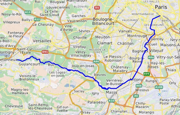
The Bievre is about 20 miles long, running through the southern suburbs of Paris before it merges with the Seine in the central city:
People have been modifying the Bievre for centuries. Medieval monks diverted its waters into a series of canals and moats. Manufacturers — most famously the Gobelins family, which supplied tapestries and upholstery to France’s monarchs — established workshops and manufactories on the banks of the Bievre by the 1400s. Papermakers, leatherworks, dyers, and more lined the river and dumped their waste into it.
Things got so bad that the street running along the river was named Rue Mouffetard, which is derived from the word for skunk. The name likely evoked the workshops that were skinning skunks along the river, but it was also a nod to the stench coming from its foul waters. Despite occasional attempts to clean the waterway, the government of Paris mostly gave up on it, putting a lid on parts of it as early as the 1500s.
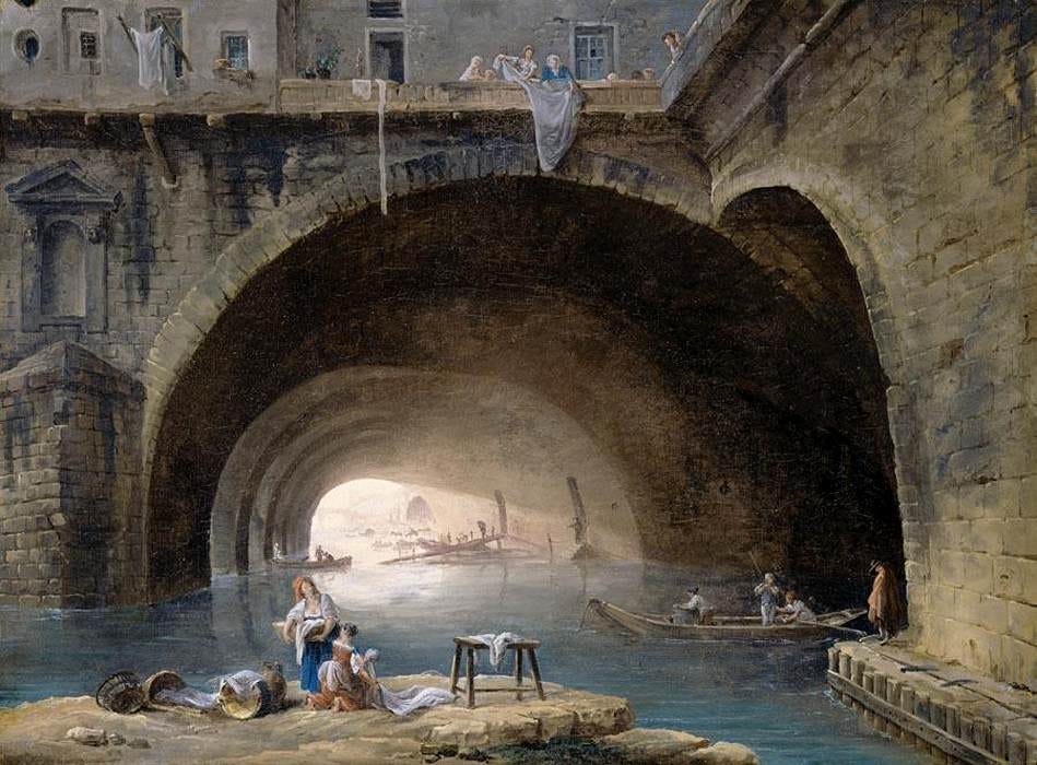
This painting by Hubert Robert from 1768 gives a sense of the heavy use the river received, along with the ways in which it had been tamed:
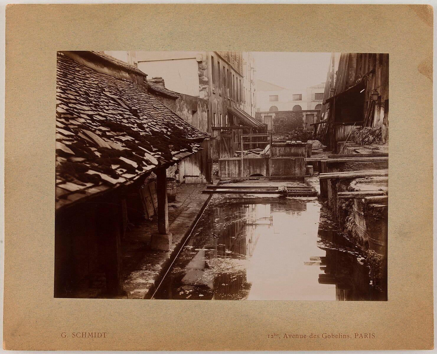
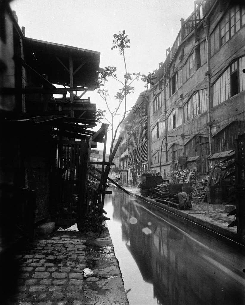
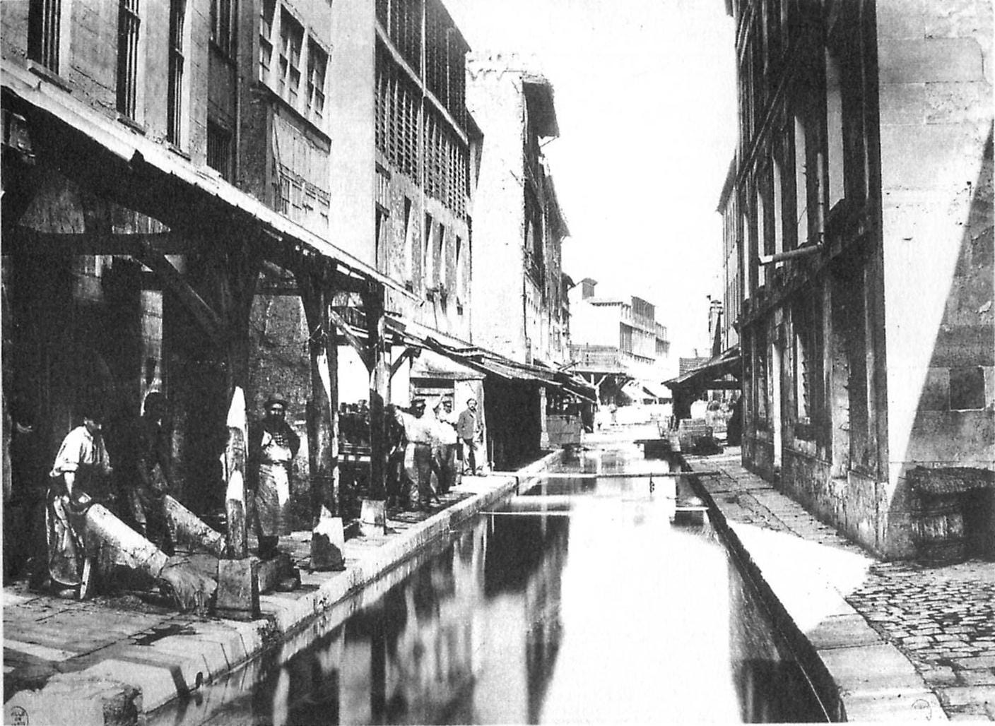
And these nineteenth-century photos show the river near the Gobelins facility:
Here tanners pose next to the Bievre:
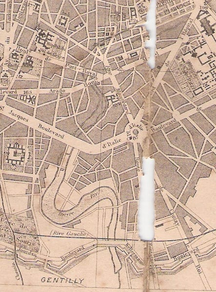
Bit by bit, Parisians made the Bievre an underground sewer rather than an open-air one. You can see part of its former route on the 1867 map:
Around the turn of the twentieth century, Josef Huymans described the state of the river with an air of bitter resignation:
From now onward, the Bièvre has disappeared, for at the end of Rue des Cordelières, modern Paris begins. Having been closed up in interminable confinement, it now appears, just barely, in the meadows and the open air. Once a country lass, stifled in the tunnels, it comes to light to draw breath in the midst of the blocks of buildings which crush it. The obsession with gain and an unlimited rage are against her once more.
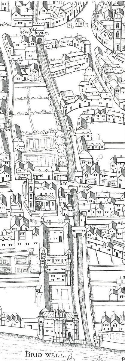
London, like Paris, is a river city. And, as in Paris, London’s main river, the Thames, remains a central feature of the metropolis, but many of its tributaries have vanished. The largest of these was the River Fleet, which flows from ponds in Hampstead Heath down to the Thames. It shows up on a 1553 map of the city, already surrounded by dense settlement:
By 1612, the river was already famously disgusting. Ben Jonson wrote a poem in 1612 imagining Odysseus taking an epic journey down the Fleet:
By this time had they reached the Stygian pool,
By which the masters swear, when, on the stool
Of worship, they their nodding chins do hit
Against their breasts. Here, several ghosts did flit
About the shore, of farts, but late departed,
White, black, blue, green, and in more forms outstarted,
Than all those atomi ridiculous,
Whereof old Democrite, and Hill Nicholas,
One said, the other swore, the world consists.
These be the cause of those thick frequent mists
Arising in that place, through which, who goes,
Must try the unused valour of a nose…
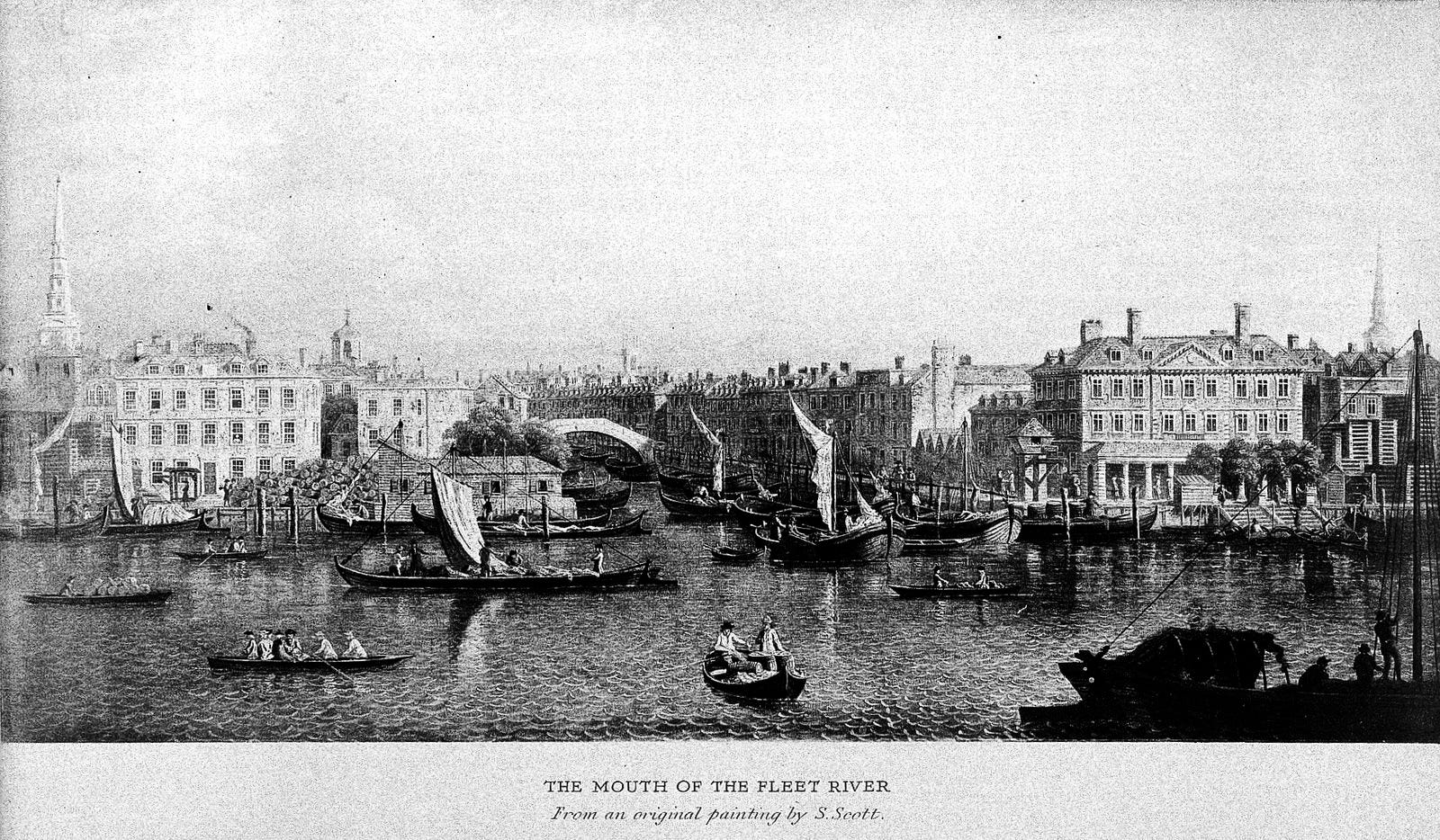
By 1725, the intersection of the two rivers looked like this:
Centuries ago, the Fleet was a significant waterway. But as more and more people settled on its banks, it became surrounded by bustling, filthy neighborhoods that dumped their trash into its waters. One of its most notable neighbors was Smithfield Meat Market, which dates back to the Middle Ages. the market featured a wide array of meat-sellers, and, out back, the livestock awaited their fate:
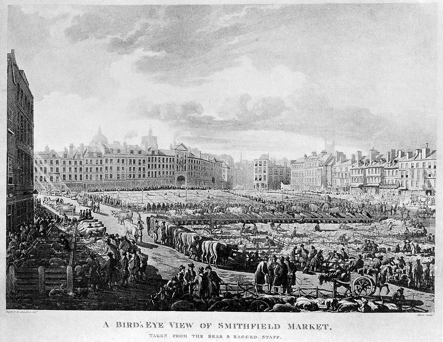
Jonathan Swift described the effect of Smithfield Market on the Fleet’s waters in 1710:
Sweepings from Butchers Stalls, Dung, Guts and Blood,
Drown'd Puppies, stinking Sprats, all drench'd in Mud,
Dead Cats and Turnip-Tops come tumbling down the Flood…
One hundred and thirty-three years later, urban reformer T.J. Maslen saw Smithfield as a blight on the urban landscape.
Of all the horrid abominations with which London has been cursed, there is not one that can come up to that disgusting place, West Smithfield Market, for cruelty, filth, effluvia, pestilence, impiety, horrid language, danger, disgusting and shuddering sights, and every obnoxious item that can be imagined; and this abomination is suffered to continue year after year, from generation to generation, in the very heart of the most Christian and most polished city in the world.
Over time, the flow of the Fleet diminished, clogged with all manner of hideous waste; people started calling it Fleet Ditch rather than a proper river. Parts of it were canalized to regulate its flow. Eventually, London’s leaders treated the Fleet like Paris’ officials treated the Bievre — that is, they closed it off. Out of sight, out of mind.
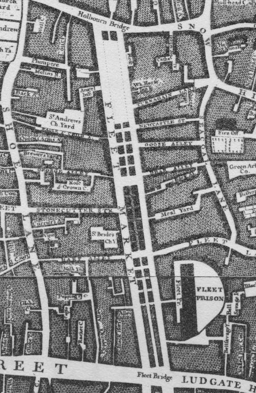
In the 1730s, part of the Fleet was capped, and Fleet Market was built on top of it, as you can see on this 1746 map:
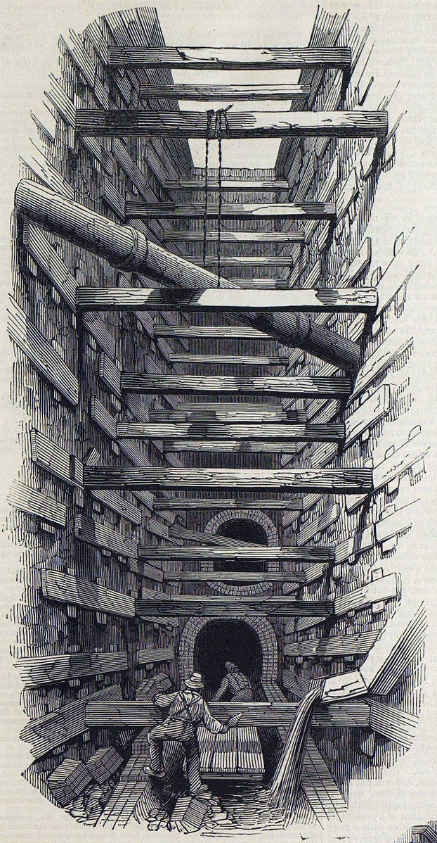
By the middle of the 1800s, the entire length of the river had been covered over. Joseph Bazalgette incorporated much of it into the sewer system he designed to stop the devastating disease outbreaks that kept hitting London. In some places, as shown in this 1845 drawing, the river was buried deep underground:
And that’s where the Fleet stays today, an underground sewer rather than a living river.
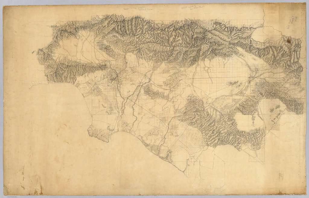
Los Angeles’ story is a little bit different. While people wanted to tame the Bievre and the Fleet because of pollution, they wanted to tame the LA River because of its unpredictability. The river flows down from the mountains that surround Los Angeles, as you can see from the 19th-century map:
Rainfall in the area was quite variable, and so was the river’s flow. In rainy seasons, it filled up and moved about, flooding wetlands. In dry periods, it mostly disappeared. This was good for the local ecosystems, which were quite robust. It also suited the local tribes who lived there, as the river provided water, hunting grounds, and vegetation to eat. But it meant the river wasn’t useful in the way that white settlers wanted a river to be useful.
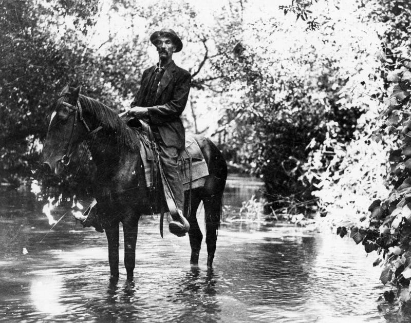
This photo from 1911 shows a policeman crossing the river by horse; the river is still quite natural:
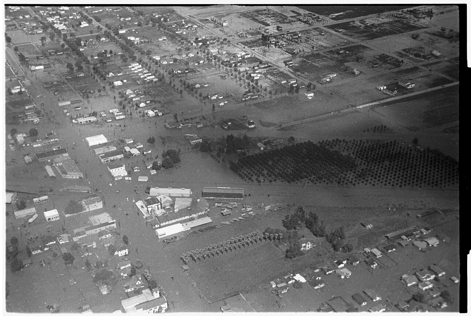
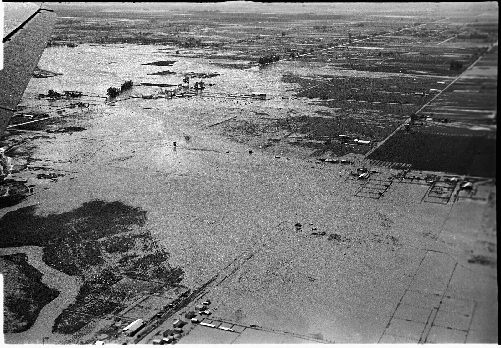
The river’s unpredictability meant that it was pretty tame for years at a time, encouraging people to think that they could build near it. Then, when the rains came, the flooding was terrible. As LA boomed in the early twentieth century, there were bad floods in 1914 and 1934. The flood of 1938 was even worse:
After the rains, North Hollywood looked like this:
The city decided to channelize the river, getting its waters out to the ocean as quickly as possible (an interesting decision given that Los Angeles didn’t exactly have abundant water for drinking and irrigation; it chose to get its water from other parts of California and beyond while shuttling its local water into the Pacific as rapidly as possible).
The project was massive:
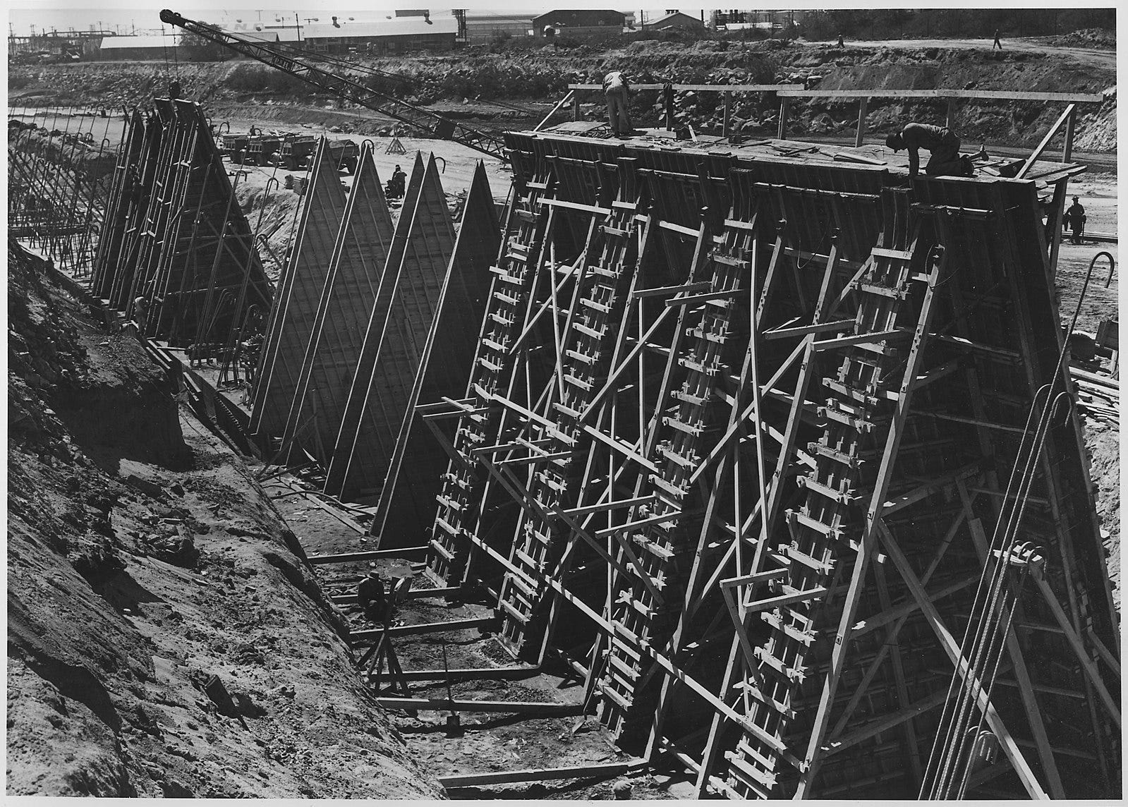
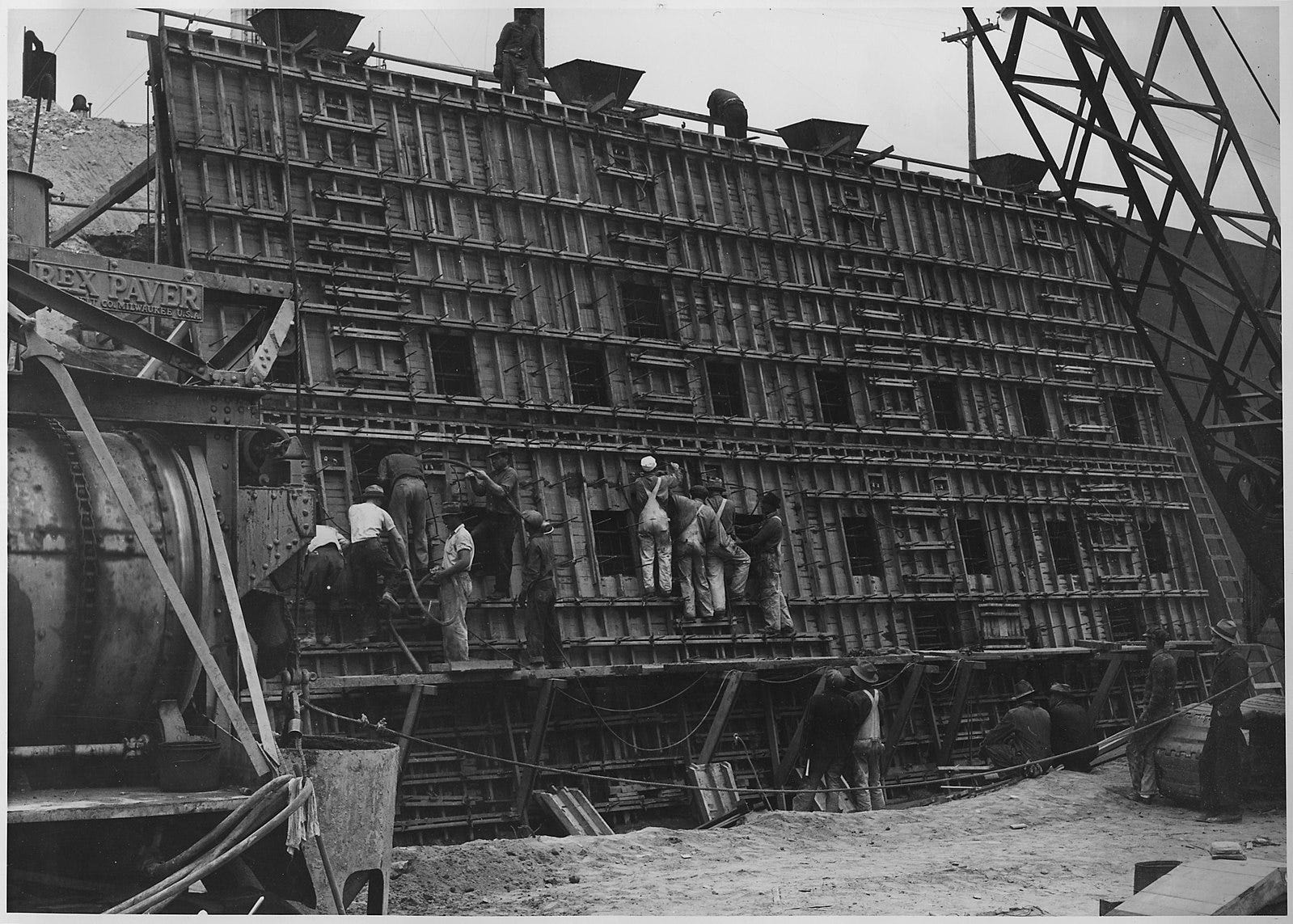
According to an excellent 99% Invisible podcast on the subject,
Over the next 21 years, the Army Corps of Engineers moved twenty million cubic yards of earth, poured 2 million cubic yards of concrete, and placed nearly 150 thousand pounds of reinforced steel. “It remains the largest public works project west of the Mississippi,” says Jenny Price, a writer and public artist who used to give tours of the LA River.
By midcentury, the river was walled off from the rest of the city, encased in concrete and looking nothing like its old self:

.png#mw-jump-to-license)
.jpg)
Most, if not all, urban rivers have been profoundly altered by the people who live on their banks. Some of them have ceased to be rivers at all. But there is some good news. Modern cities don’t (or shouldn’t) dump untreated human and animal waste into their local waterways the way they did 100 years ago. We also have stricter regulations on other types of pollution. On top of this, there’s more interest in making some space for nature in our urban environments.
Over the last few decades, some of these godforsaken rivers have gotten a new chance at life. Cities with buried rivers — Seoul was the first — have begun to “daylight” their waterways by bringing them back out into the open. There’s talk in Paris of doing this for the Bievre. And in Los Angeles, activists kayaked the length of the river to prove that it was a “navigable” waterway deserving of legal protection from pollution. These waterways may never get back to their old, meandering, biodiverse selves, but many of them are moving in the right direction — away from being a sewer and toward being a river again.
This newsletter is free to all, but I count on the kindness of readers to keep it going. If you enjoyed reading this week’s edition, there are two ways to support my work:
You can subscribe as a free or paying member:
Or you can share the newsletter with others:
Thanks for reading, and I’ll see you again next week!
Crazy, that we humans kill even rivers. How utterly sad.
Have lived in London all my 56 years and though of course familiar with the Fleet river, didn’t know it’s source was at Hampstead Ponds. Great post, George. Fascinating as ever.